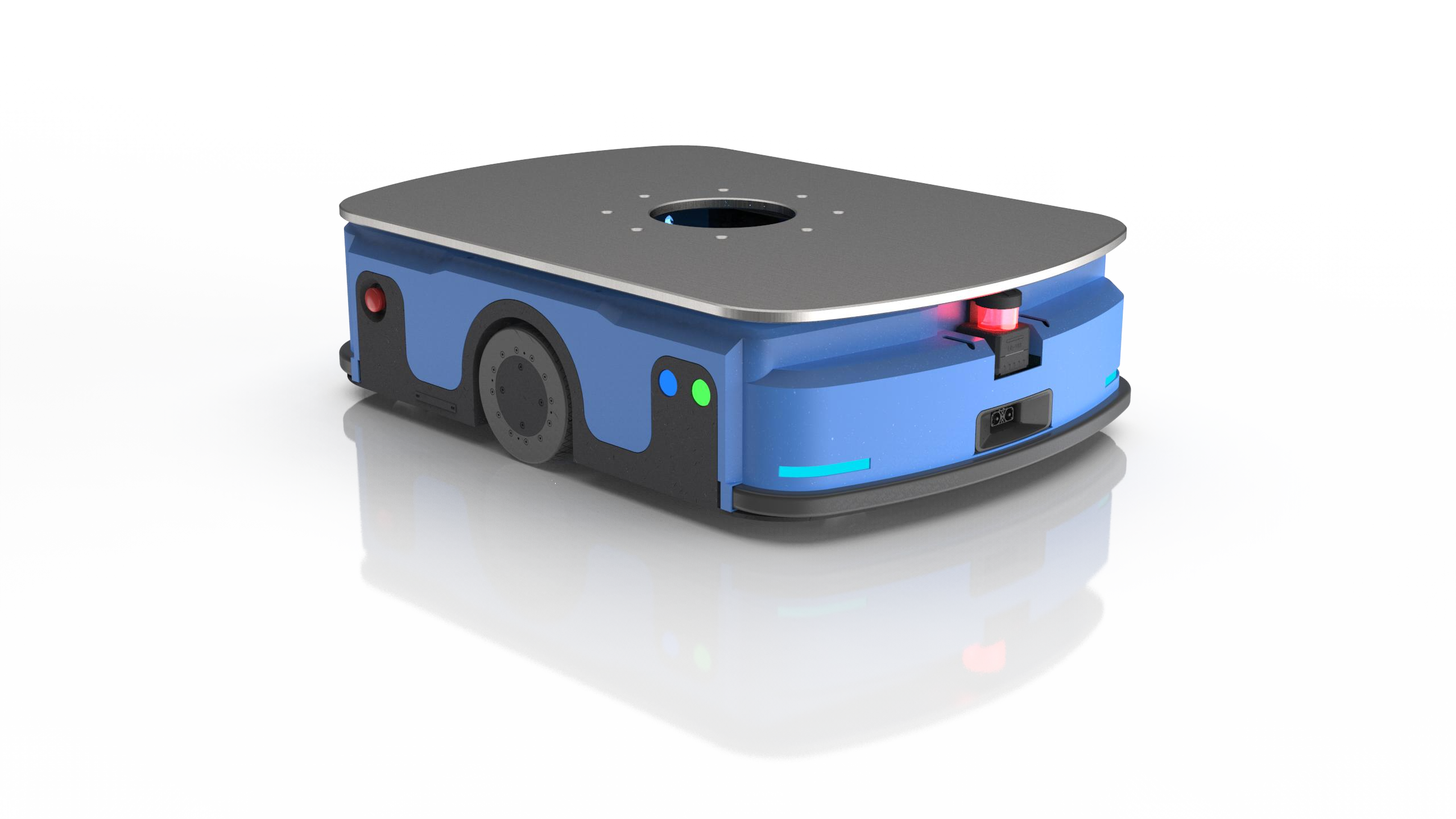
Under Drive lifting Moving Robot W3-600B
LiDAR SLAM Navigation +QR Code Navigation+600kg Load
Product Features
1. The Lidar SLAM autonomous navigation mode is adopted for rapid deployment. The equipment only needs to scan the environment to build a map and achieve accurate positioning of ± 5 mm.
2. The carrying capacity is 600kg, and it can complete most of the goods handling transport through lifting and rotation.
3. The equipment adopts the modular design of the whole machine, which makes the assembly and maintenance more convenient.
4. The battery life can last for more than 8 hours with full load, and the robot can automatically charge with low power (set the low power value according to the customer's requirements).
5. Cluster scheduling, in the robot control system, you can view the working status, electricity, location and other information of all robots at the same time, and schedule all devices through the system.
6. Equipped with LiDAR safety barrier avoidance, front contact anti-collision bar, left and right emergency stop buttons, multiple safety protection to protect equipment and cargo safety.
7. Realizing unmanned operation by the system path planning, and the staff only need to give instructions through the control terminal.
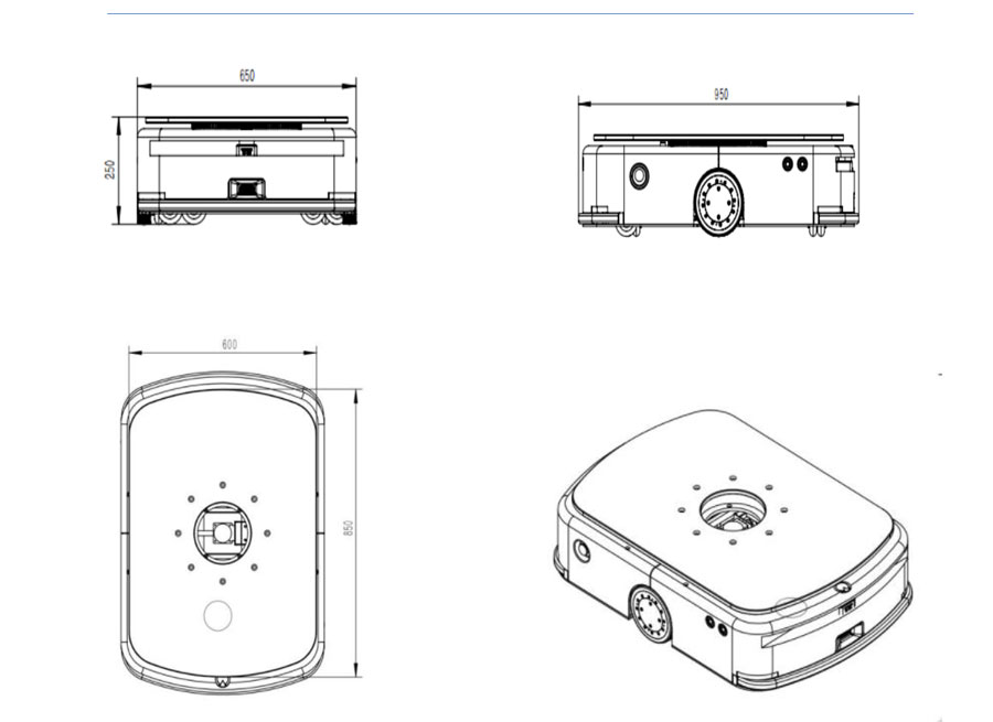
Dimension

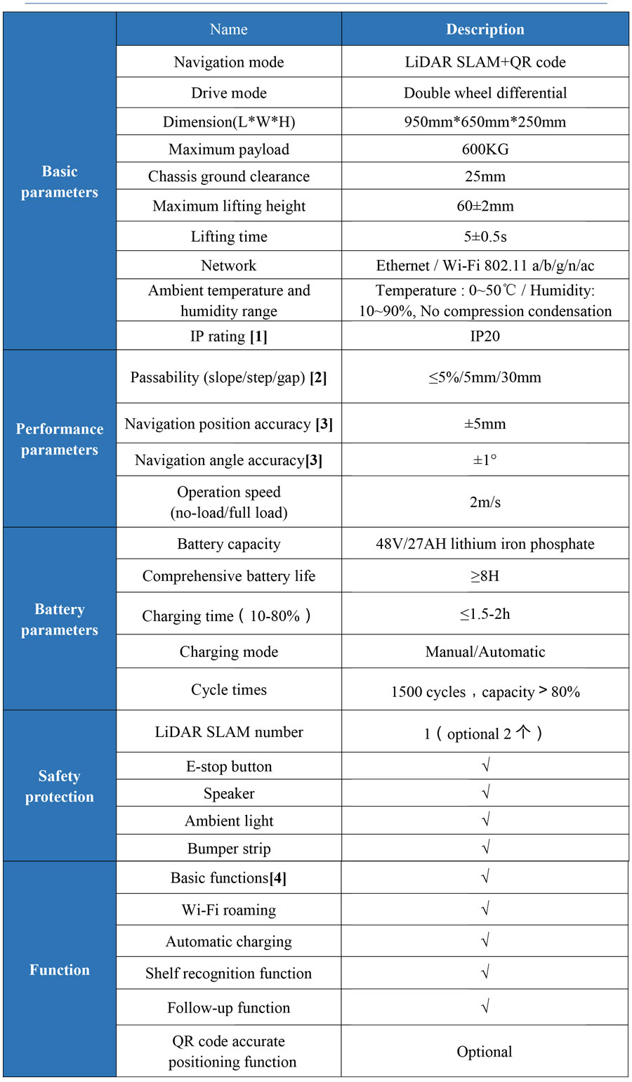
Specification

[1]. Designed for indoor transport, not recommended for outdoor environments.
[2]. Road surface is smooth, clean and without significant undulations. Slope 5% = arctan(0.05) ≈ 2.8°. The robot may not stop or turn at ramps, steps, or gaps, but may only pass quickly perpendicular to them.
[3]. Navigation accuracy usually refers to the repeated accuracy of the robot navigation to the target site. When the environment scanned by the robot LiDAR is relatively stable (change rate <30%), the repeated accuracy of the robot navigation from the fixed direction to the target site can reach the expected value. When the robot runs along the virtual path, it will try to fit the path, but it does not guarantee repeatability. That is, the robot can guarantee the accuracy of the point, without guaranteeing the accuracy of the navigation path. The minimum site spacing supported by the robot is 1cm.
[4]. The basic functions include map editing, model editing, positioning and navigation, basic motion model (differential), API interface, etc.
